On the map of trade routes in the Middle Ages the green lines signify ____________ while the purple lines are __________________. 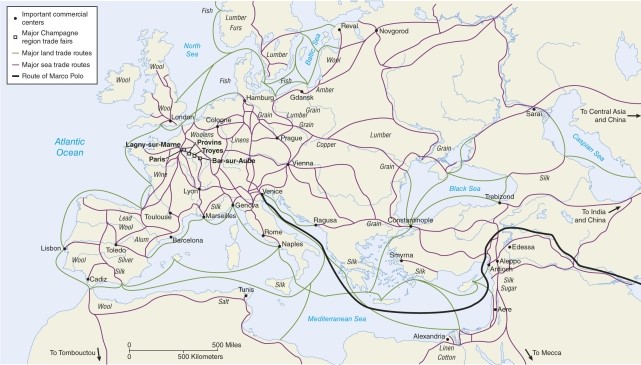
A) political boundaries;cultural watersheds
B) mountainous physical boundaries;railroads
C) sea routes;land routes
D) German roads;Roman roads
Correct Answer:
Verified
Q3: During the Middle Ages which is an
Q4: In the Middle Ages two main axes
Q5: World areas with no urban development before
Q6: Iron enabled
A)better plows to be made.
B)better axes
Q7: In Chang An, China a city was
Q9: After the Roman Empire the entire basis
Q10: Urban networks tied together in some meaningful
Q11: The Franks, the Burgundians, the Ostrogoths, and
Q12: One main reason for the development of
Q13: In the Roman Empire, roads connected cities
Unlock this Answer For Free Now!
View this answer and more for free by performing one of the following actions

Scan the QR code to install the App and get 2 free unlocks

Unlock quizzes for free by uploading documents