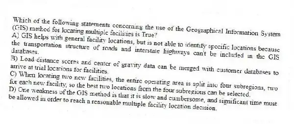
Which of the following statements concerning the use of the Geographical Information System (GIS) method for locating multiple facilities is True?
A) GIS helps with general facility locations, but is not able to identify specific locations because the transportation structure of roads and interstate highways can't be included in the GIS databases.
B) Load-distance scores and center of gravity data can be merged with customer databases to arrive at trial locations for facilities.
C) When locating two new facilities, the entire operating area is split into four subregions, two for each new facility, so the best two locations from the four subregions can be selected.
D) One weakness of the GIS method is that it is slow and cumbersome, and significant time must be allowed in order to reach a reasonable multiple-facility location decision.
Correct Answer:
Verified
Q82: Which of the following is an example
Q83: Geographical Information System (GIS) tools are useful
Q84: Forward placement is a reduction in inventory
Q85: A geographic information system contains demographic information.
Q86: The transportation method is customarily used to
Q88: One disadvantage of centralized placement is increased
Q89: Which of these is not identified as
Q90: Consider the transportation tableau shown below. What
Q91: Which location shift would qualify as forward
Q92: What are the components and capabilities of
Unlock this Answer For Free Now!
View this answer and more for free by performing one of the following actions

Scan the QR code to install the App and get 2 free unlocks

Unlock quizzes for free by uploading documents