This image would be best used in what situation? 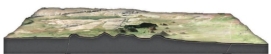
A) A petroleum company wants to know if any geologic structures in the area could contain oil pools.
B) The thickness of the surface layer of rock needs to be determined for a construction site.
C) The average gradient for a particular area needs to be known to study surface runoff.
Correct Answer:
Verified
Q54: What type of map is used primarily
Q55: What type of map is shown here?
Q56: Slopes in flatter areas are:
A) gentle
B) elevated
C)
Q57: Which letter on the accompanying figure indicates
Q58: If you wanted to determine how deep
Q60: What specific type of map represents the
Q61: This figure shows the main subdivisions of
Q62: Which of the following are ways in
Q63: If a runner races 50 meters in
Q64: Which of the following is an example
Unlock this Answer For Free Now!
View this answer and more for free by performing one of the following actions

Scan the QR code to install the App and get 2 free unlocks

Unlock quizzes for free by uploading documents